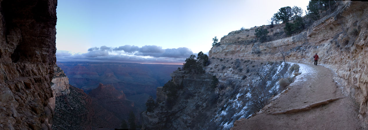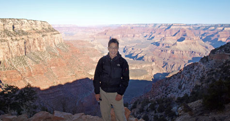
8:34am Still in deep shadow, but partly because it's a beautifully clear day and partly because we are at altitude here (nearly 7000 ft above sea level), we can look forward to a day of brilliantly strong sunshine ahead:
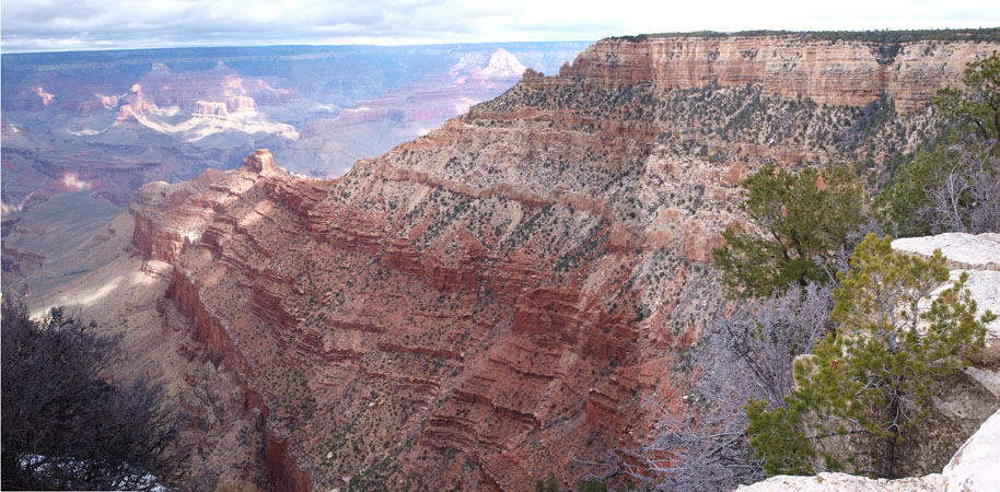
(Still, such scenes with wide dynamic range create big problems for digital cameras. The human eye with its iris is able to see both bright scenes and into shadows without washing out or dropping into barely discernable black. Not so with current cameras and LCD display technology, unless one is willing to compress all that dynamic range artificially. But I digress...) 9:13am Cedar Point. The trail opens out here. The first flat spot. (Also, the first available bathroom stop.)
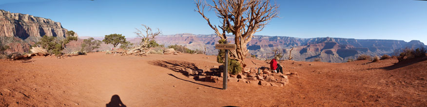
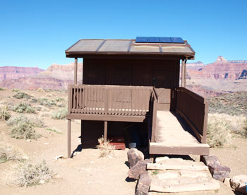
(There is a considerable amount of inaccurate information in the official park documentation that I sorta hesitate to correct here. Probably, it's inaccurate for good reasons. For example, the South Kaibab trail is listed as having only one restroom stop. This is not true. There is one here at Cedar Point. But there is also one near where the Tonto Trail crosses, which is pictured further down on this entry. And both restrooms were certainly around back at the time of my first hike in 2004.) 9:25am I put the following picture in to serve two purposes:
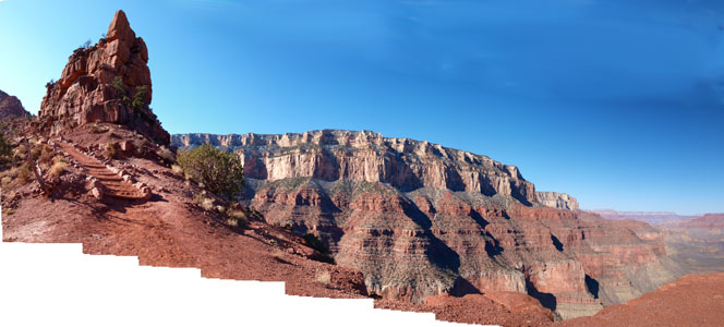
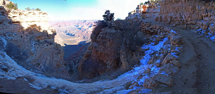
- First, you can see how I shoot the panoramas using an ordinary moderately wide-angle (28mm EFL) lens attached to my Olympus E-520 DSLR. Pictures are merged together automatically using Autopano Pro or Adobe Photoshop Elements. (Actually, I have an ultra-wide-angle 16mm EFL fisheye lens too for my spherical panorama photography (shown elsewhere on this blog. But shot merging gives zoomability and incredible detail at full resolution.)
- Second, remember I said the eye/brain can have problems parsing the scale of the features correctly? Well, compare the butte in the foreground with the South Rim in the background. And look back at the picture taken from Yaqui Point earlier (2nd one down on this entry). You see what I mean?
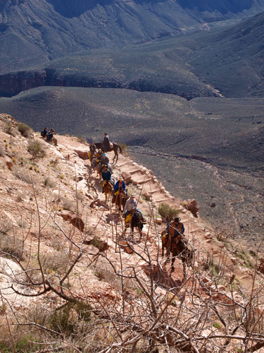
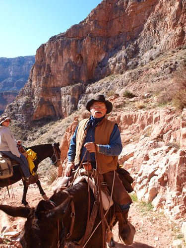
10:12am Okay, let me switch gears for a moment. From huge geological features billions of years old to human scale objects. Two pictures of a mule train coming up the Kaibab:
10:47am Told you there was another toilet coming up:
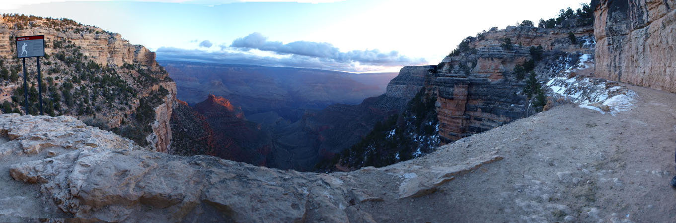
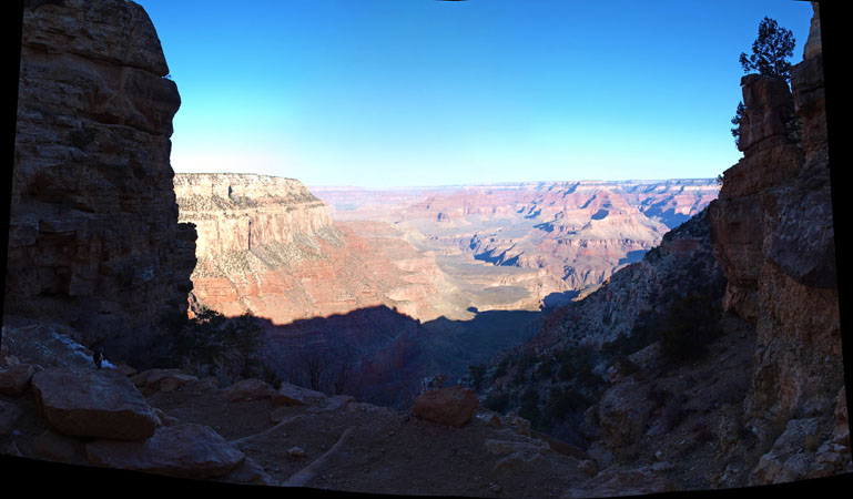
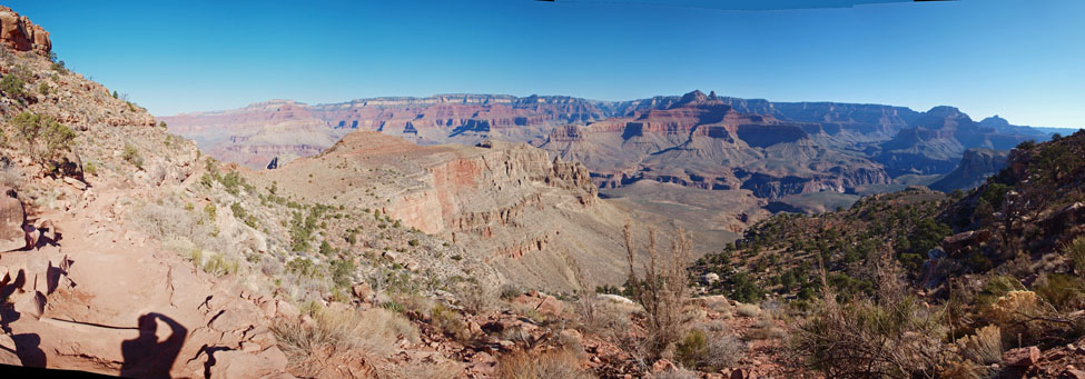
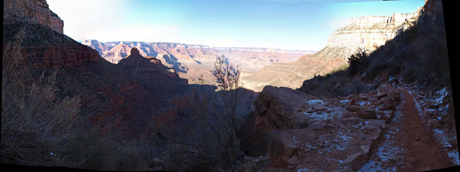
10:51am Back to awesome scenery. Some great colors here. Scroll sideways for the full effect. (You can see the Colorado River to the left. And the trail etched in the deep red on the right.)
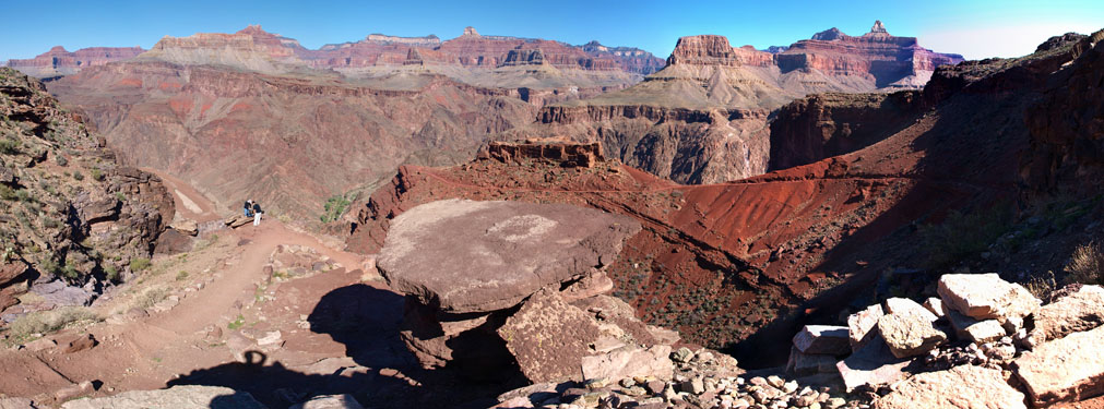
(Those two law students just below my vantage point are from California on a fun weekend trip. Nice guys. They were well-equipped and properly provisioned but it's going to be a bit of a long day for them. Of course, variations in weather conditions at the Canyon can play a big role: it can be freezing at the top and 100F at the bottom. (Today it's about 70-75F at the bottom, very pleasant conditions.) However, their buddy had already turned back. And as we passed them later on Bright Angel on the way back up, one of them was looking very tired indeed. Another rather tired solo hiker we encountered on the way back up Bright Angel (wearing a big backpack) referred to herself humorously as "I'm one of those they warn about". See previous blog entry or my 2004 webpage for the warning sign reference.) 11:22am The Colorado River down below. (It takes 3 hours to reach the Colorado. Took about the same time as when I first did it in 2004.)
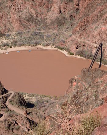 You should be able to spot the three river rafts and of course the suspension bridge we're going across to get to Phantom Ranch, but you probably can't make out the people doing yoga poses on the river bank.
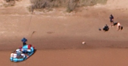
Well, ergo zoom (a detail from the picture above):
You should be able to spot the three river rafts and of course the suspension bridge we're going across to get to Phantom Ranch, but you probably can't make out the people doing yoga poses on the river bank.
Well, ergo zoom (a detail from the picture above):
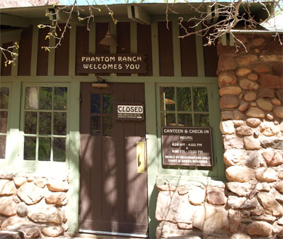
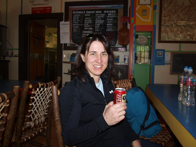
12:36pm I wanted to get back up to the South Rim in plenty of time for sunset. But I insisted on hanging around, i.e. wasting time, until they re-opened, so I could have my cold beer. Sasha was gracious enough to honor my request:
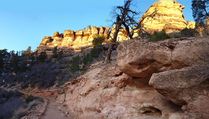
2:15pm Ascending the Bright Angel trail. It's going to be quite a slog. (That foreground feature looks huge, but again it's nothing compared to what's dwarfing it back there. Later on, this effect can become psychologically important. One might think the top of the rim is close but it's actually still hours away.)
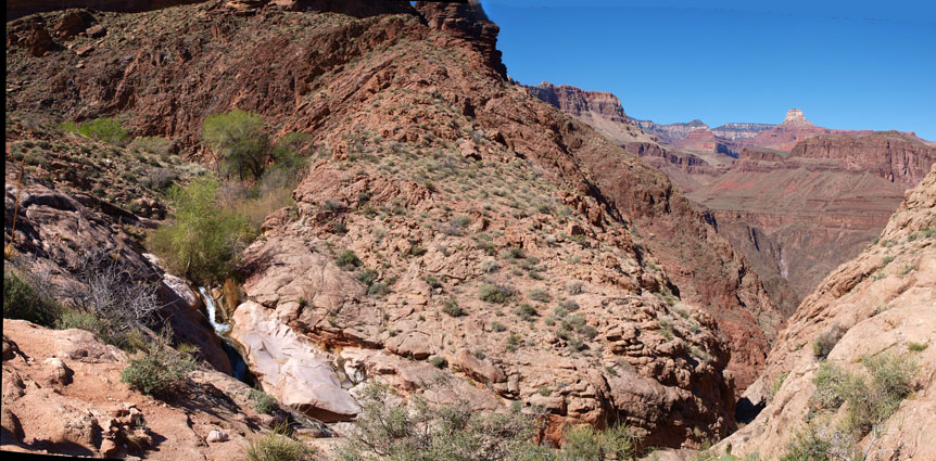
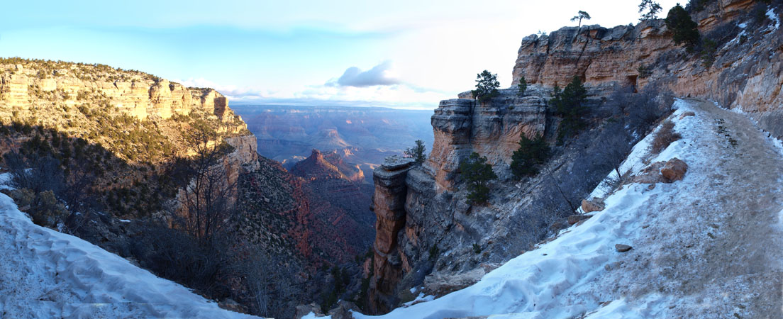
2:35pm Nearly to Indian Gardens (which is psychologically the halfway point on Bright Angel), the scenery narrows but remains interesting:

Excellent timing! We easily made the South Rim in plenty of time for the sunset (around 6:30pm). Highly recommended and hugely enjoyable. It's a must-do (if you are in decent shape).