Showing posts with label mt lemmon. Show all posts

Friday, December 12, 2008

BMW G 650 GS: One week anniversary

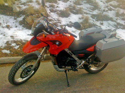
I bought a motorcycle for commuting last week, see previous blog entry.

One week later, I took it for its first non-commute ride to celebrate my first week of motorcycling. Mt Lemmon was the destination.

From Tucson (2595 ft). Ascended the back side of Mt Lemmon (peak: 9157 ft) to the village of Summerhaven (around 8000 ft) using the unpaved and unmaintained Control Road from Oracle. Basically dirt, mud, some snow and rocks. In parts, just one lane wide: hence the name "Control Road". Nothing that would faze an experienced rider, but it kept a beginner like me fully occupied keeping it rubber side down on some muddy/rocky 180° turns. Another first down: a non-tarmac experience.
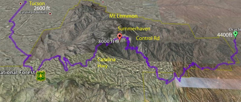
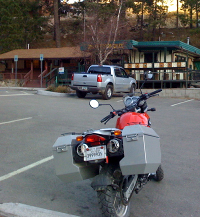
After a traditional slice of pie at the Mt Lemmon Cafe in Summerhaven just before it closed at 4pm, it was down the well-paved and maintained Catalina Highway back into Tucson. The (standard) heated grips came in handy.

Still learning how to ride, I corned gingerly with not much throttle roll-on. At the low speeds I'm currently employing to avoid overcooking a corner, it feels a little strange.

Having descended the Catalina Hwy many times flat-out on my road bicycle, barely braking even for the 180° hairpins, everything feels much more deliberate and ponderous on the motorcycle. Maybe it's due to the environmental isolation afforded by full motorcycle leathers, gauntlets and full-face helmet compared to polyester/lycra and a helmet with more holes than a kitchen sieve. But it actually seems less fun.

Total: a scenic 100 mile loop.
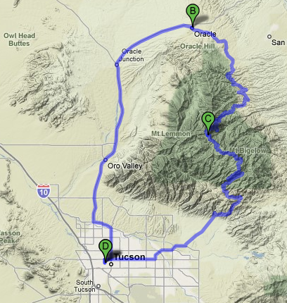
[D: University of Arizona, C: Summerhaven. B: Oracle.]

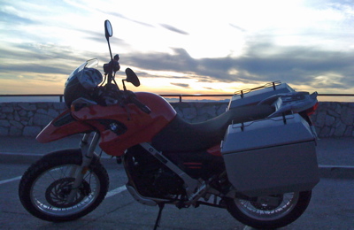
A brief stop halfway down at Windy Point on the Catalina Highway to admire the sunset:
Sunday, November 4, 2007

Arizona 200km Brevet (Mt Lemmon)

Yesterday, I attempted the hardest 200k brevet I've tried to date. See http://www.azbrevet.com/. Great route, I hope Susan Plonsky (the RBA) decides to make it a permanent fixture.

62.5 miles from Dove Mountain on Tangerine Rd to the turnaround point in Summerhaven at the end of the Catalina Highway and nearly to the top of Mt Lemmon - and back - makes for an epic 200k. A nice touch is that we got to mail a postcard (provided) at the (closed on weekends) postoffice in Summerhaven. Zip code up there past 8000ft is 85619.

As a local, I've done the Mt Lemmon climb many a time. However, I haven't attempted it after a 5 month layoff before - my last ride was at the end June after the transcontinental, so I knew I was going to suffer. I've been trying to become a runner exclusively this semester, so my quads weren't getting the workouts they needed. I didn't think I was going to have to get off my bike a dozen times though.

My stomach cramped up on the climb - I use Sustained Energy and dosing is critical for me: too much and my stomach rebels (as it did yesterday), too little and I bonk. Build up of tolerance is another factor. I switched immediately to plain water. That makes the stomach cramps disappear but then of course my stomach is not processing correctly and on a climb of this magnitude I ended up bonked anyway. That's when it got difficult: riding half mile chunks, stopping, and riding a bit more until I hit the Palisades checkpoint (mile 20 on the climb) where Susan was waiting with food and a drop bag. A banana and some brownies and I started to recover.

Five miles remaining to Summerhaven to mail the postcard and back down to the Palisades where I ate a sandwich for lunch. I then rode the rest of the brevet with Alan Marmostein, finishing at 4:40pm having started at 7am. We'd started off in the same group but Alan simply was too strong for me as soon as we started the Mt Lemmon climb. And he probably outweighs me by 50-60lbs. Ouch! He is clearly in excellent shape. (BTW, Carol Havrda from Colorado finished at 3:12pm.)

About 20 miles or so into the ride, the lead rider just a minute or two up the road got hit by a car exiting a road onto Sunrise. Separated shoulder and squished disc in the back. Paramedics were there even before our group arrived. Turns out it happened next to a firehouse. Rather sobering as always to see a rider down, but at the same time it was reassuring to see that he got immediate medical attention.

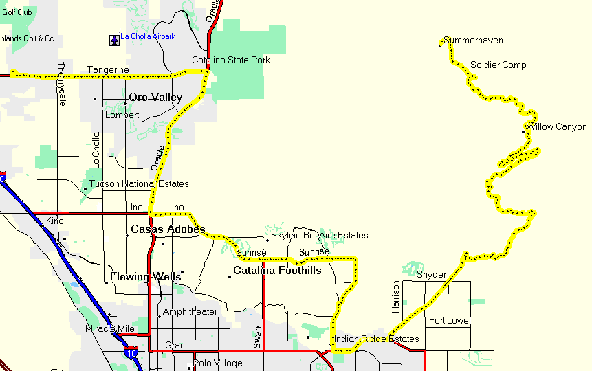
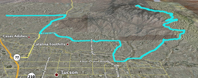
Some ride details now... I carried a Garmin etrex vista to record the route.

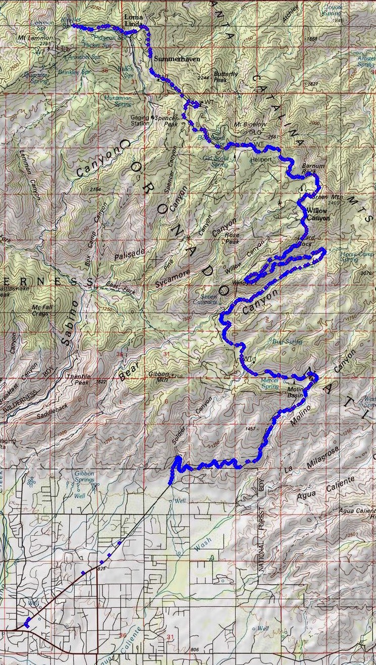
1. Mapsource:

2. Google Earth:

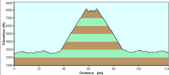
3. The profile, total 8700ft of climbing:

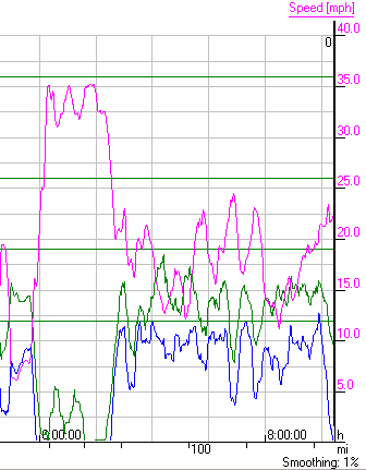
4. The descent from Mt Lemmon from my SRM powermeter.
It's a bit unexpected but I could keep up with Alan Marmostein here despite him outweighing me by 50%. Hey, I'll take anything positive given my rough day.
There was a 15 mile run scheduled for Sunday morning at 6:30am. Needless to say, I didn't make that...

Sunday, May 13, 2007

Mt Lemmon: climb to Ski Valley

Sometimes I forget, but there is a world-class road climb right on the edge of town. It's called Catalina Highway and it climbs Mt Lemmon.

Stats? Start at the intersection of Tanque Verde and Catalina Highway (alt: 2550 ft, 778m). It tops out in Ski Valley (alt: 8350 ft, 2546m). A bit over 30 miles long. A (5800 ft, 1768m) climb. Looking to go under the 3 hour mark with moderate fitness, under 2:30 if in real shape.

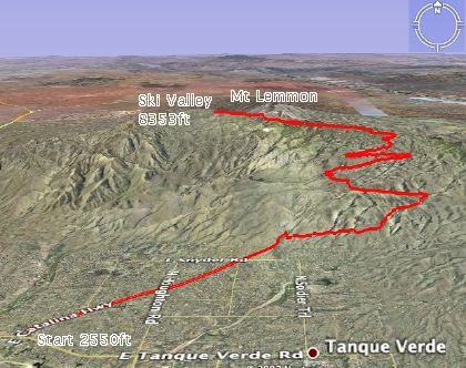
See the GPS route plotted on Google Earth:


{Click here for a larger image.]

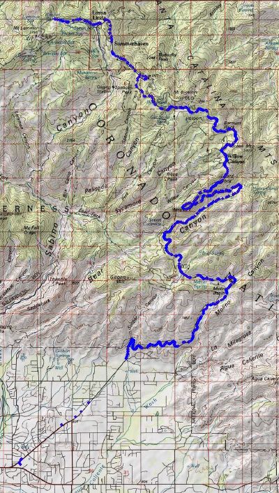
See the GPS waypoints plotted on National Geographic Topo!:


{Click here for a larger image.]

In summer, the temperature in Tucson regularly reaches 40C (over 100F). Climbing Mt Lemmon can make sense in this heat. Start early in the morning, say 7:30am when the temperature is in the 20s (70sF). When the temperature reaches 40C, you will be at the top of the mountain where the temperature is likely to be 23C.

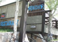
Unfortunately, this year travel and catch-up when home have taken their toll on bike fitness no matter how much I swim and run. But with a major event coming soon in June, I need to see where I am on the fitness curve. So today, I climbed to Ski Valley and had a late breakfast at the Iron Door restaurant.

Here are some of the checkpoints and baseline fitness marks I use. I carried 60oz of water, just enough to not need refilling.

Named
Section
(Approx)
Mile marker
Notes
Warm-up 4.5 miles (up to mile marker 0) Straight and relatively flat before entering the Coronado National Forest.
Windy Point Vista mile marker 14 Almost halfway. About 6000ft up.
Baseline Timecheck: 1:50 (hr:mins).
Turn back here if fitness has deserted you.
Summerhaven mile marker 25 Turn right to keep climbing to Ski Valley.
Baseline Timecheck: 2:50 (hr:mins)
Ski Valley mile marker 27 Steepest section of the road to the top. Irondoor restaurant at Ski Valley. Ski lift can take you to 9157ft (2791m).
Baseline Timecheck: 3:00 (hr:mins)

Tech:

I used a small Magellan eXplorist 600 GPS receiver mounted on the handlebar stem.

The eXplorist has a USB interface which allows the device to appear like a hard drive to the computer. Files can be simply copied off the device for processing.

It records a tracklog, each line of which looks something like:

$PMGNTRK,3215.545,N,11047.879,W,00778,M,142226.79,A,,130507*61

The Magellan file format has to be converted into KML (Keyhole Markup Language) for Google Earth. GPSBabel+ is free software that can do this automatically.

For National Geographic Topo!, I reformat the lat/long fields slightly (as shown below) and import directly via the Wizard.

$PMGNTRK,32.15545,N,110.47879,W,00778,M,142226.79,A,,130507*61