Showing posts with label magellan eXplorist 600. Show all posts

Sunday, June 3, 2007

Kitt Peak climb

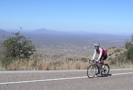
Kitt Peak is one of two climbs around Tucson that I really like.
Specs?
12 miles, climbing 3560 ft (1085m).

Dead end road (built to transport massive telescopes) tops out at 6795 ft (2071m).

[Photo courtesy of Jim Montgomery.]

(The other area climb is Mt Lemmon, see earlier blog entry here.)

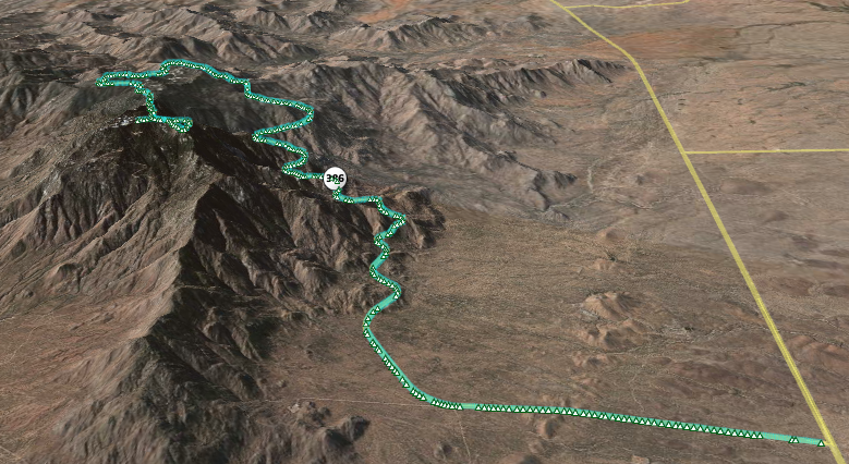
Here is the GPS tracklog from the Magellan eXplorist 600 plotted on Google Earth:


{Click on the picture for a larger image.]

As you can see, the 12 mile road to the observatories at the top rises gently at first. A right hander, then it starts climbing properly.

An excellent test of fitness. It took me 1:30, which means I lost considerable bike-specific fitness during my travels despite running and swimming nearly every day. No faking out the mountain. Brutually revealing. 1:15 would have been a good time (for me).

The bumpy descent (20 mins) turned out also to be a good test of the Magellan GPS receiver. It switched off by itself on the descent. The tracklog shown above is from the climb.
Update: Unfortunately, the eXplorist 600 seems hosed. Have to send it back to Magellan to see if it can be repaired. With PacTour Elite Transcontinental only one week away, that's not enough time, plus it's already way out of warranty. I ordered a Garmin Vista Cx on Monday. Hope to get it Wednesday.

Tuesday, May 29, 2007

Run #2: Hong Kong

[See previous Run #1]

Run #2 is the climb to the Peak on Hong Kong island. (Run #1 is on the Kowloon side.)

Unlike run #1, this one is very demanding. Steep. Short. Sweet. Best done in the cool hours of early morning.

However, to compensate there are wonderful views of course at the top, and it's quiet, car-free and tree-lined after the initial section.

And you have the satisfaction of not taking the Peak Tramway that carries 4 million tourists each year.

At a bit less than 1.5 miles, it climbs from around 200ft if you start from where I start to nearly 1400ft. Think of it like a demanding short trail run in the mountains except it's on concrete.

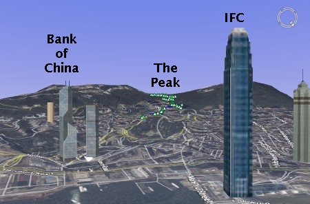
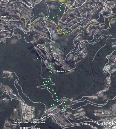
My GPS tracklog from the Magellan eXplorist 600 using Google Earth (with 3-D buildings turned on):

It's amusingly sparse. Compare the above with a photo I took:

Details?

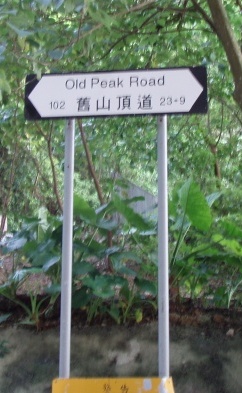
  1. I begin at the Botannical Gardens in front of the memorial to the Chinese who died in the two world wars. Jog through the gardens, to the Panther enclosure, and out the back. Cross the road at the light onto Old Peak Rd.
  2. Road is very steep and lined with high-rise condos.
  3. Switchbacks are over 20% grade.
  4. The road becomes a one lane road here. Cars and motorcycles are prohibited.
    This is where the nice part begins but are you still running?
  5. Toilets if you need them.
  6. The grade even lets up in places to maybe 5%.
  7. Near the top now. Did you last?
  8. The top of the tramway is in view. Up the stairs.
  9. Turning around, the view back down.

Last, I want to revisit the tracklog on Google Earth again. Here, it's plotted from above:

As you can see, the Magellan struggles here to maintain 3-D coverage. Multipath off the tall buildings? Tree cover?

run #1: Hong Kong

There are some runs that simply take your breath away. For example, I think of Waikiki along the shore to Diamond Head. Nature sets a tough standard that's hard to beat.

Skip to Hong Kong.

There is a very special one mile walkway in Tsim Sha Tsui (Kowloon) from the old (train station) clock tower along Tsim Sha Tsui East to Hung Hom. Run there and back twice and it's a 4 mile run.

What's so special about this one mile of concrete? The view as you run. One of the most celebrated harbor views in the world.

When to run? Early in the morning, as the sun rises, before the tourists jam the walkway rendering it unusable for running and before the summer heat becomes oppressive.


The view? Difficult to describe exactly, but each lap offers a slightly different perspective as the rising sun slowly illuminating the skyscrapers over on Hong Kong island.

But you see a much wider field of view when running. Only a panorama can capture this. This was taken around 7am.

Turn up the music on the iPod, stare at the view and you can even forget you need wings to fly for a moment or two...

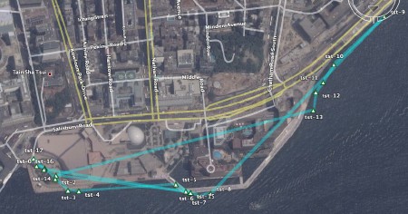
Details? I carried a GPS. Here is the route as mapped by Google Earth:

[Unfortunately, I had a lot of trouble with the Magellan eXplorist 600 in Hong Kong. Never got completely clean tracklogs. Too much electronic interference? For a larger image of the route, click here.]

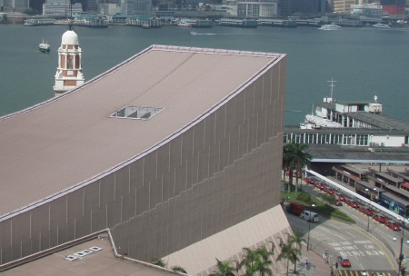
Start here at the clock tower partially occluded by the cultural center:

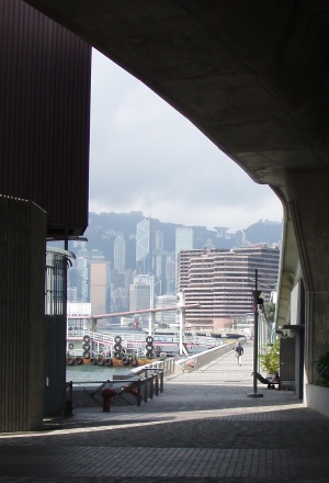
The path ends here just below the flyover at Hung Hom:

Amazing Hong Kong run #2 to follow...

Sunday, May 13, 2007

Mt Lemmon: climb to Ski Valley

Sometimes I forget, but there is a world-class road climb right on the edge of town. It's called Catalina Highway and it climbs Mt Lemmon.

Stats? Start at the intersection of Tanque Verde and Catalina Highway (alt: 2550 ft, 778m). It tops out in Ski Valley (alt: 8350 ft, 2546m). A bit over 30 miles long. A (5800 ft, 1768m) climb. Looking to go under the 3 hour mark with moderate fitness, under 2:30 if in real shape.

See the GPS route plotted on Google Earth:
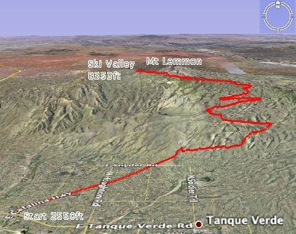

{Click here for a larger image.]

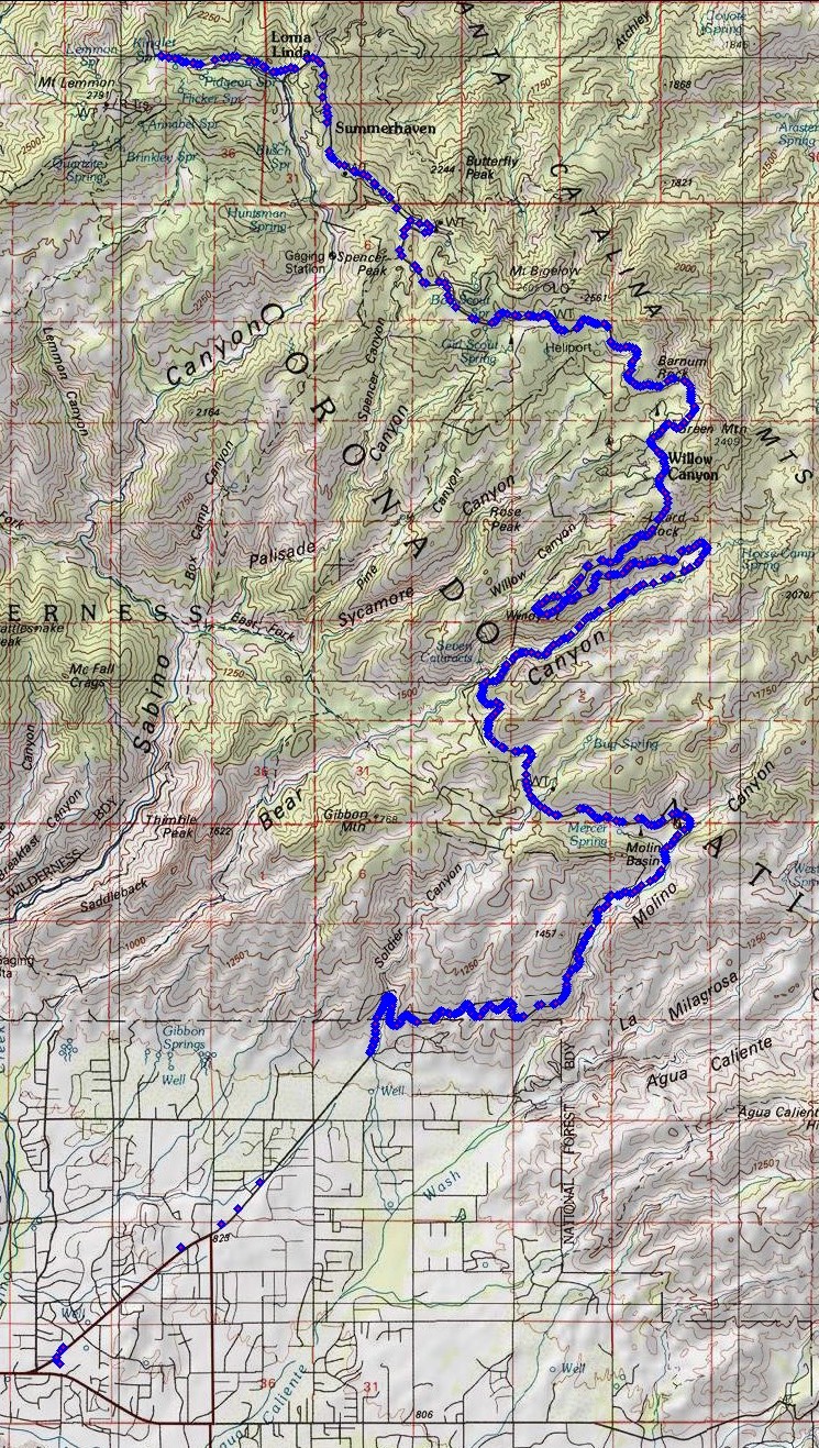
See the GPS waypoints plotted on National Geographic Topo!:
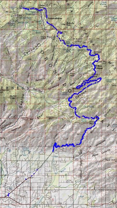

{Click here for a larger image.]

In summer, the temperature in Tucson regularly reaches 40C (over 100F). Climbing Mt Lemmon can make sense in this heat. Start early in the morning, say 7:30am when the temperature is in the 20s (70sF). When the temperature reaches 40C, you will be at the top of the mountain where the temperature is likely to be 23C.

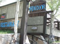
Unfortunately, this year travel and catch-up when home have taken their toll on bike fitness no matter how much I swim and run. But with a major event coming soon in June, I need to see where I am on the fitness curve. So today, I climbed to Ski Valley and had a late breakfast at the Iron Door restaurant.

Here are some of the checkpoints and baseline fitness marks I use. I carried 60oz of water, just enough to not need refilling.

Named
Section
(Approx)
Mile marker
Notes
Warm-up 4.5 miles (up to mile marker 0) Straight and relatively flat before entering the Coronado National Forest.
Windy Point Vista mile marker 14 Almost halfway. About 6000ft up.
Baseline Timecheck: 1:50 (hr:mins).
Turn back here if fitness has deserted you.
Summerhaven mile marker 25 Turn right to keep climbing to Ski Valley.
Baseline Timecheck: 2:50 (hr:mins)
Ski Valley mile marker 27 Steepest section of the road to the top. Irondoor restaurant at Ski Valley. Ski lift can take you to 9157ft (2791m).
Baseline Timecheck: 3:00 (hr:mins)

Tech:

I used a small Magellan eXplorist 600 GPS receiver mounted on the handlebar stem.

The eXplorist has a USB interface which allows the device to appear like a hard drive to the computer. Files can be simply copied off the device for processing.

It records a tracklog, each line of which looks something like:

$PMGNTRK,3215.545,N,11047.879,W,00778,M,142226.79,A,,130507*61
The Magellan file format has to be converted into KML (Keyhole Markup Language) for Google Earth. GPSBabel+ is free software that can do this automatically.

For National Geographic Topo!, I reformat the lat/long fields slightly (as shown below) and import directly via the Wizard.

$PMGNTRK,32.15545,N,110.47879,W,00778,M,142226.79,A,,130507*61